Voice of the Danube
IAWD member Mozaika works at the forefront of digitalization in the water sector. We gladly share their contributions and insights. Part of a current project they have been contracted for by the European Space Agency is the operationalization of their Information System for Monitoring of Water Resources for Sustainable Exploitation of Rivers and Dams (ISME-HYDRO®) and its deployment in real-life daily monitoring of segments of the Danube.
The management of rivers and hydropower reservoirs involves daily monitoring of water resources, meteorological conditions, the status of the coast, flood areas, etc. Water resources managers rely on periodically collected information from a wide variety of sources, including detailed data about the condition of water bodies like rivers and reservoirs, water economic data, meteorological data and forecasts, and geographical/geospatial information about water bodies and their contingent environment.
These data are heterogeneous, and usually viewed separately, in processes which demand high levels of expertise and precision from water resources managers who analyse and summarize the evidence to come up with adequate conclusions and action plans. Providing timely, easy-to-consume information, analytics and early warnings about current and upcoming statuses or events helps water resources managers and authorities to adequately plan, decide and operate in the sustainable development of river areas.
In these processes, data collection can be tedious and ridden with inaccuracy risks. In-situ measurements are taken either by automated sensor stations and stored in adjacent devices, or manually by human operators who forward the data to other human operators for manual recording. More often than not, water resources managers and hydrologists use excel sheets to record and analyze daily data, timeseries of various categories of in-situ measurements, and other information of interest.
For fairway monitoring purposes, specialized software, e.g. CAD/CAM, produces daily updated maps showing the navigational conditions in critical sections of rivers. Ideally, these maps are issued as PDF files.
In such an information environment, decision-making in critical situations will involve consulting multitudes of excel sheets and/or PDF files. This is time-consuming and makes it difficult to connect the dots by overviewing larger datasets, making links with other relevant data, and organizing the necessary information in concise manner to produce reliable analyses and conclusions. Even in routine daily operations, consulting separate files for a variety of purposes does not make for an efficient workflow.
Here lies the big promise of web-based information and decision support systems for the water sector and especially water resources management. Web-based applications give access to various sources of information via one single interface for a smooth, highly efficient workflow. Replacing individually installed programs on single computers, they are accessible through most web browsers on all kinds of mobile and stationary devices, and will perform uniformly on every operating system, regardless of update and version status.
Web-based application content is customizable for use on a wide variety of devices, including mobile, to support field teams and give decision-makers information access wherever and whenever required. For example, operators collecting in-situ measurements can upload their data directly into the application, making information accessible in real-time instead of going through time-consuming and error prone manual data entry and validation routines. Integrating and combining web-based applications with other systems for smooth functional interoperability is uncomplicated and risk-free.
Web-based systems are much easier and less expensive to maintain, with maintenance carried out through a central point. Another advantage is their upscaling capacity and flexibility in expanding the application to include additional functionalities, components, and simultaneous processes. Hardware infrastructure headaches become a thing of the past. Furthermore, web-based applications excel in the field of data security. Direct server access is only for authorized persons or teams. Cloud computing servers can be fully redundant and replicated to prevent downtime. Centralized security measures and unauthorised access prevention are the easiest and most efficient path to data safety.
All this adds up to a recommendation for web-based applications as an easily developed, installed and managed gateway to a more flexible, efficient, effective and secure work environment[1] in water resources management.
GIS (GIS 2021) and SCADA (SCADA 2021) are examples of one-stop applications that provide a single interface allowing to visualize geospatial and operational information. However, these solutions show particular limitations in interacting with data, especially when it comes to reviewing data correlations for past and future circumstances, predictive analytics, and integrating features like hydrology, hydrodynamics, fairways, and flood that are crucial for the high-quality water resources management.
This is why we have created ISME-HYDRO® - the optimized and disruptively novel in the age of AI and Earth Observation web-based water resources management application.
ISME-HYDRO® supports an intelligent web-based workflow. It combines various AI methods including linked data, deep learning and reasoning to provide an integrated information system that ensures interoperability between spatial information of Web maps, remote sensing information, symbolic and numerical data like meteorological data and proprietary measurements to create an actionable knowledge value chain for the needs of river and hydropower reservoir exploitation.
ISME-HYDRO® also employs hydrodynamic modelling using Telemac with forecasted water economic data, produced from earth observation and in-situ measurements applied to a series of neural network architectures to derive predictive river models. Those are integrated into the work-flow and available for querying, reviewing, projecting changes in the navigational conditions of rivers, including geo-spatial visualization on Web maps.
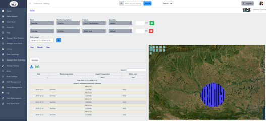
The intelligent workflow further provides functional features like forecast generation for river discharge, turbidity, water level, and querying of a variety of correlations and synchronized visualizations in tables, graphs and Web maps. ISME-HYDRO® helps to improve operational efficiency by providing the ability to review, and interact with, all water resources management information at once, it ensures accuracy and decision-making ability by correlating historic and forecast data with satellite imagery and data, gives automated forecasting of water economic data using satellite meteorological data, and reduces risk through automated alerts.
The advantages of ISME-HYDRO® for the monitoring of rivers and their environment for sustainable development, operations and planning have currently been assessed on the Bulgarian segment of the Danube.
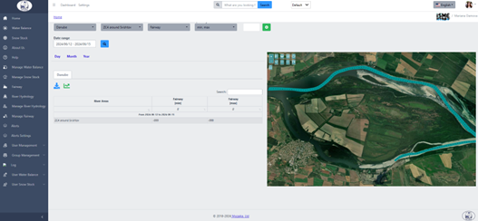
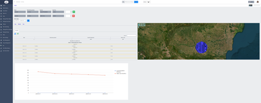
Here is a flavor of its functionalities and user facing interface:


